Alta’s analytics team provides advanced network analysis methods to understand gaps in multimodal transportation networks and identify how improvements can change people’s access to opportunities.
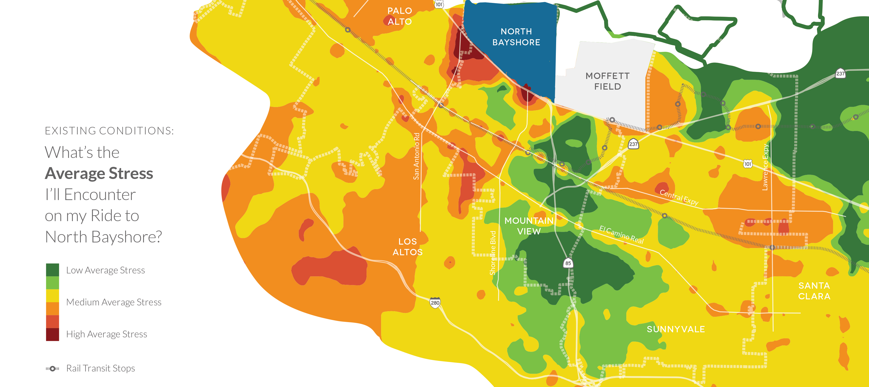
Alta’s innovative GIS-based network analysis and mapping tools are essential for understanding a community’s existing pedestrian and bicycle networks and for helping it realize its full potential. For example our level of stress, systemic safety, demand, and other analyses help communities make data-driven decisions for bikeway gap closures, road diets, traffic calming devices, and ADA-compliance.