
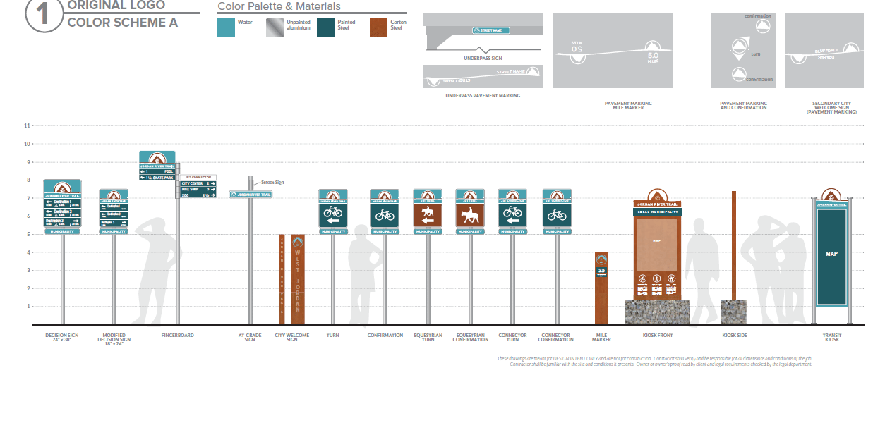
The trail extends 45 miles through fifteen cities and three counties. This wayfinding plan will be implementable the various cities’ streets and public works departments. More complex elements, such as “city welcome signs” and map kiosks will be bid out to local sign shops for fabrication and construction. One primary goal of wayfinding plan is to increase awareness of the trail system and to help encourage residents and visitors to become more physically active by using the trail for recreation, commuting, and for exercise.
Alta is leading all tasks, including existing conditions analysis, stakeholder coordination, site considerations, permitting, review of sign regulations, development of a phased implementation plan and maintenance plan, and 100% design that includes final design intent plans, cross-sections, and technical specifications for sign placement.