
Enhancing Connectivity: Thunder Bay’s Pedestrian Wayfinding Strategy
Alta led the development of a comprehensive Pedestrian Wayfinding Strategy for the City of Thunder Bay, designed to reflect its rich cultural diversity while enhancing existing wayfinding systems. This plan aims to create a more seamless, accessible, and engaging experience for both residents and visitors through a thoughtfully designed network of signage, maps, and visual design standards.
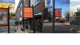
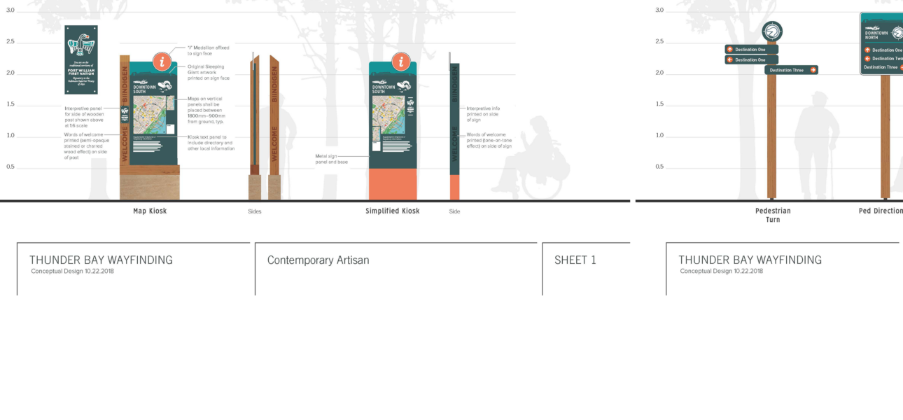
The Wayfinding Plan introduces a cohesive sign family, strategic sign placement guidance, and branding elements to ensure clarity and consistency. More than just directional aids, these wayfinding strategies serve as a promotional tool—encouraging physical activity, strengthening active transportation links, and helping newcomers feel more connected to their surroundings.
A key focus of the plan is the pedestrian and bicycle wayfinding system, which supports increased use of Thunder Bay Transit by improving access to and from the city’s five major transfer points. Extensive public engagement and outreach to Indigenous communities were central to the plan’s development, ensuring the wayfinding system is reflective of the local population and its unique identity.
Additionally, the plan includes an assessment of equipment, signage options, and cost considerations for pedestrian-level wayfinding on public streets and trails. Elements such as branding, visual appeal, user-friendliness, maintenance, and long-term affordability were carefully evaluated to ensure a system that is both functional and sustainable.
By creating a well-integrated wayfinding strategy, Thunder Bay is taking a significant step toward improving mobility, fostering inclusivity, and enhancing community connections—making the city more navigable and welcoming for all.