
Sullivan County has partnered with Alta on various phases of this project to see that the local community will one day enjoy this groundbreaking trail. These include detailed feasibility studies and recommendations, wayfinding implementation, preliminary engineering services, and engineering analysis.
Rail Trail Feasibility Study
The historic corridor of the O+W railroad presents an exceptional opportunity for over 50 miles of contiguous multi-use rail trail through the verdant valleys and scenic overlooks within Sullivan County, New York. Presently there are 25 miles of trail developed, but these segments are disconnected and in varying condition. This plan provides not only a design concept for the trail, but also a consistent brand and marketing strategy and a road map for upgrades, phased build out, and operations maintenance. Alta led this planning effort, conducting all field work, analysis, and meetings, as well as developing all recommendations and implementation measures to identify the trail route throughout Sullivan County.
Rockland and Liberty Trail Feasibility Study
The Sullivan O+W Livingston Manor to Parksville Trail Feasibility Analysis was completed in summer 2022 in partnership with Alta, Sullivan County, the Town of Rockland, and the Town of Liberty. The team conducted a detailed engineering analysis of six miles of the northern terminus of the rail trail.
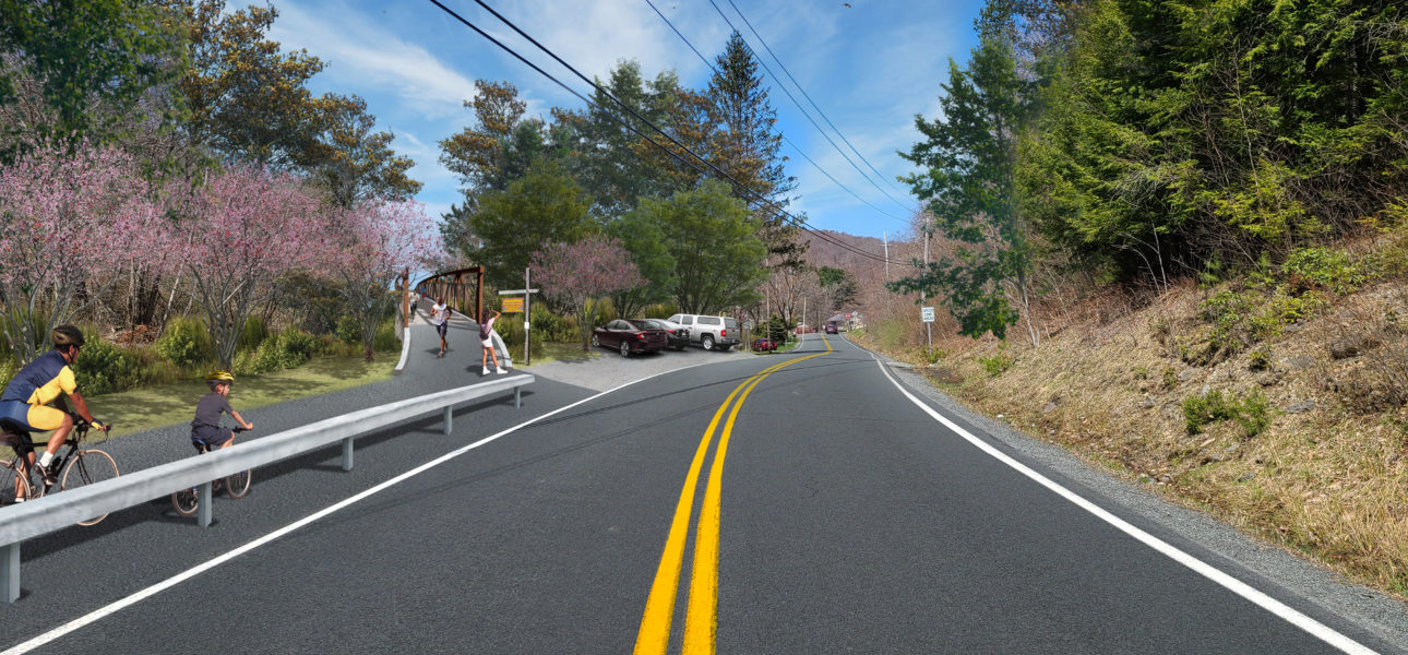
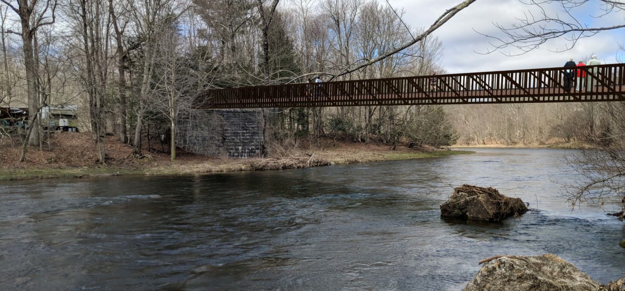
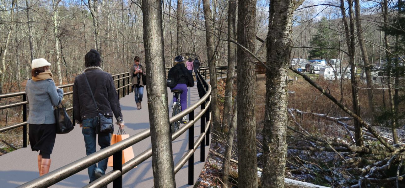
Fallsburg Neversink Gap Preliminary and Final Engineering
Nestled in the hills and deep woods of the Catskills, the O+W rail line is being transformed into the Sullivan O&W rail trail one piece at a time. One of the more challenging sections extending approximately 2,500 ft. includes a 40 ft. elevation gain that will be traversed by a 180 ft. bridge span over the Neversink River, and a 108 ft. timber boardwalk. Alta provided preliminary and final design engineering services for this segment of trail. This project evaluated several horizontal and vertical alignments to determine the preferred trail route within the 100-foot right-of-way, then evaluated impacts to the surrounding landscape, and prepared construction documents and estimates for the County and Town of Fallsburg. The project was designed to be ADA compliant, and additional features include the preparation of photo simulations to better illustrate the anticipated finished project.