The Pro Walk/Pro Bike/Pro Place conference connects walking, biking and placemaking professionals, with the belief that greater access to walking and bicycling will create healthier individuals, cohesive neighborhoods, and vibrant communities. The conference is coming to Vancouver, BC, this year on September 12-15 and is expected to draw 1,000 city planners, transportation engineers, public health professionals, elected officials, community leaders, and professional walking and bicycling advocates.
At this year’s Pro Walk/Pro Bike/Pro Place conference, Alta will be celebrating our 20th anniversary of creating healthy, safe, vibrant, and active communities. The 20th anniversary of Alta founding is an occasion to celebrate—not just for the accomplishments of this innovative company, but for the flourishing movement that has sprang up to improve walking and biking across America. This progress is the result of the commitment and dedication of the public, our clients, and our elected officials, and a reflection of the creativity and hard work of our staff.
We invite you to stop by our exhibition booth at the conference, and find us at the following presentations:
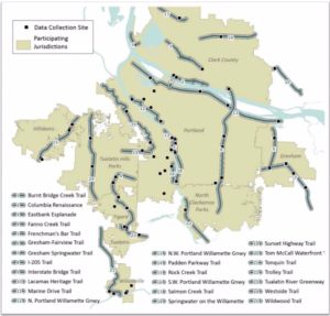
Intertwine Count Data – Extrapolating Short Term Trail Counts to Annual Volumes using Localized Extrapolation Factors
Monday 9/12 4:00 PM:
The Intertwine is a network of trails, parks, and open spaces in the Portland-Vancouver metropolitan region supported by a coalition of 140+ public, private, and nonprofit organizations. Every year since 2008, Metro, the Portland regional government, organizes volunteers to count bicyclists and pedestrians at sites across the Intertwine using the National Bicycle and Pedestrian Documentation Project methodology.
This poster presents a methodology for extrapolating data collected from these manual counts to annual volumes using localized extrapolation factors. The extrapolation factors were calculated using over 100,000 hours of infrared count data collected on trails across the Intertwine and provide an accurate way to account for temporal variations in trail use in the region. Understanding how many people use the trail system is essential for planners and decisions makers.
Build It, but Will They Come?: Using Individualized Marketing to Maximize Your Infrastructure Investment
Tuesday 9/13 9:45 AM:
You’ve built some gorgeous cycle tracks and installed piles of bike racks. Your transit agency has increased frequency or added new service. In short: you’ve done everything right. But where are the users?
Attend this session and learn about simple – yet uniquely effective – Individualized Marketing (IM) campaigns that have significantly increased the use of active and shared modes. Panelists will highlight IM approaches in four different contexts: the southern sunbelt in Austin, neighborhoods in San Francisco and Seattle, and the unique cultural challenges of a military base in the Pacific Northwest. Presentations will touch on the goals, funding, audience, and strategy for each location, before delving into the unique challenges and successes that can be applied to creating your own programs. In this era of demonstration projects, green lanes, and arterial transformations, it’s time to revisit IM as a cost-effective tool to connect your users to the infrastructure they have been waiting for.
Active Transportation in Canada’s New Geometric Design Guide
Tuesday 9/13 11:00 AM:
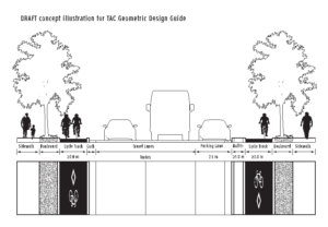
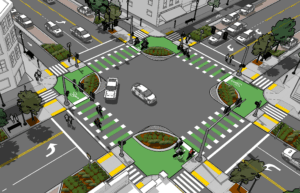
It has been more than 15 years since the Geometric Design Guide for Canadian Roads (GDG) — a primary transportation design resource for Canadian planners, designers and engineers — was comprehensively updated in 1999. Since that time, a sea change has occurred in the field of pedestrian and bicycle transportation with the emergence of complete streets, the introduction of protected bicycle lanes and a growing consensus that active transportation should play a central role in urban transportation systems. Stantec Consulting and Alta Planning + Design were tasked with updating the pedestrian and bicycle chapters of the GDG to better reflect the state of the practice. This presentation will share highlights of the proposed updates (which are pending approval by the Transportation Association of Canada), focusing on guidance that empowers practitioners to prioritize safety and convenience for people walking and riding bicycles. Proposed improvements to the GDG include: better design guidance for off-street facilities, new bikeway types (e.g. protected, advisory and contra-flow bike lanes), intersection designs and crossing treatments (including protected intersections), among many other topics. The presentation will highlight some of the variation in American and Canadian designs, offering the opportunity for input and discussion concerning the merits of each approach.
Are We There Yet? Better Evaluation For All
Tuesday 9/13 11:00 AM:
It’s time to raise the bar on evaluation. Is our work making a difference? What are the most effective ways to reach our audience? We need to have good answers to get the funding we need and to ensure we’re making smart investments. Attend this session to learn innovative and proven evaluation techniques you can apply to your work.
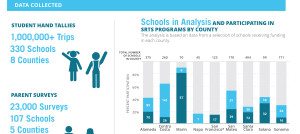
The San Francisco Bay Area’s Metropolitan Transportation Commission (MTC) has funded a 9-county Safe Routes to School program since 2011. Learn how MTC has taken standard SRTS evaluation further with new methods that show significant impacts and help maximize program efficiency and effectiveness.
TransitCenter, a national think tank about smarter urban mobility, commissioned a study about innovations in evaluating behavior change campaigns. Learn to tell richer and more insightful stories using new methods for evaluation drawn from other fields such as applied anthropology and health psychology.
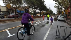
Better Block PDX implemented a tactical urbanism project during the city’s busiest summer festival. Working closely with the PSU engineering department and the Portland Bureau of Transportation, they developed a data collection and monitoring plan to tell the real story about changes to volume, travel time, and diversion.
Tale of two cities: Reshaping the conversation on safer street design
Tuesday 9/13 1:45 PM:
What does the “Emerald City” and the “Gateway to the West” have in common? Well, both cities are working towards progressive and inventive ways to reengage the public in planning opportunities for safer street design.
The City of Seattle used a design contest to build community involvement and promote street safety pilot projects. Through diverse partnerships, the city used a design contest format to elicit safety improvement ideas from community members and designers. This collaboration resulted in temporary demonstration projects across the city. They will discuss the winning projects, and how using tactical demonstration projects lead to successful leverage for projects to be built permanently!
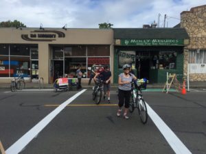
In the City of St. Louis, Trailnet wanted to change the conversation around traffic calming through cross-sector collaboration. They used pop-up traffic calming demonstrations to educate community members, elected officials, and city staff on how we can work together to create safer, vibrant, and healthy communities through lighter, quicker, cheaper projects. Further, Trailnet created a how to guide to teach others how to implement their own pop-up demonstrations for change. Learn more about how the two cities challenged the status quo and revitalized the connection between planning and community engagement.
Pedestrian Safety Campaigns That Don’t Suck
Tuesday 9/13 2:30 PM:
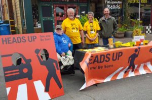
So you have a safety problem around walking, and you want to do something about it. How hard can a media campaign be? The answer: harder than you think. All too many pedestrian safety media campaigns are not memorable, unclear, or the wrong fit for the community. In this poster session, Jessica Roberts will reveal the keys to success to create a locally relevant and visually compelling pedestrian safety campaign. The poster will show (not tell) how each key to success was applied to create a popular and successful campaign in Eureka, CA.
Creating Great Walking and Bicycling Networks
Tuesday 9/13 3:15 PM:
According to data from the NHTS, for some small towns and rural communities, walking and bicycling is as common or even more common as it is in urban areas. However, infrastructure to support active transportation is often limited or nonexistent in rural places. The Small Town and Rural Street Design Guide will translate existing street design guidance and best practice for bike/ped safety and comfort to the rural context, and will be released in Summer/Fall 2016. The session will introduce the guide and show participants what flexibility in design means in rural places and how they can respond to the local context to create roads that are safe, scenic, and supportive of active communities. Participants will also have the opportunity to engage in an interactive exercise to work through potential innovative and cost effective options.
The session will highlight information from recent FHWA publications specifically relevant to the rural/small town context, including Achieving Multimodal Networks, Guidebook for Developing Bike/Ped Performance Measures, and Incorporating On-Road Bicycle Networks into Resurfacing Projects. It will highlight recent national policy changes and lessons learned from pedestrian and bicycle assessments in every state, and from the experience of smaller towns participating in the Mayors’ Challenge for Safer People, Safer Streets.
How to prioritize over $1 billion in city-wide pedestrian needs: Lessons from Memphis, TN
Tuesday 9/13 3:15 PM:
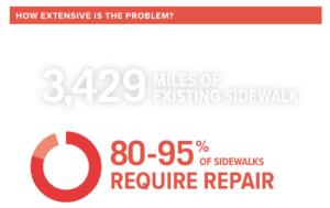
This session will describe the analysis used in the Memphis Pedestrian School Safety Action Plan. This plan seeks to prioritize over $1 billion in pedestrian infrastructure needs around the City of Memphis using school access as the organizing framework. The plan culminates in a prioritized 20-year project list the city can use to direct limited resources where they will best serve residents in accordance with City goals. It also includes several innovative analysis frameworks that can be updated over time to ensure that pedestrian investments are continually targeted where they will have the biggest impact for all types of pedestrian needs.
Weaving a smooth urban fabric: lessons learned in the Netherlands and North America
Tuesday 9/13 4:30 PM:
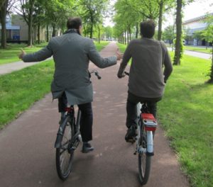
Innovation of active transportation facilities only happens when people are willing to push the boundaries of what is possible. Unfortunately, this sometimes results in less than optimal results, which only works if designers and planners are willing to learn from these results and make improvements. While the Dutch have been leading this innovation for decades, parts of North America are beginning to make great strides in innovation.
This panel features innovators who push the boundaries of what is thought possible to create livable communities on a daily basis. The panelists will focus on the lessons they have learned throughout their careers by presenting case studies, evaluation techniques and anecdotes. The session aims to create a lively, sharing discussion to find ways to encourage and continue innovation in active transportation facilities.
Bringing Health Directly Into Active Transportation Planning
Wednesday 9/14 11:00 AM:
What are clear and tangible methods for incorporating health in existing transportation planning practice? Many communities struggle to add another topic of concern into current plans. This panel will showcase two specific examples of how communities in Wisconsin and South Carolina have integrated a health focus into existing planning practices.
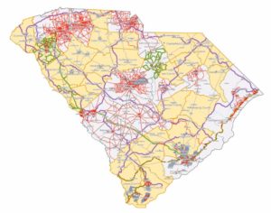
The South Carolina Department of Health and Environmental Control (DHEC) is leading a project to develop 16 community pedestrian plans around the state that specifically address equity in transportation and safe routes to healthy foods.
East Central Wisconsin Regional Planning Commission (ECWRPC) developed the College Avenue Corridor Study utilizing Federal Highway Administration’s Draft Health in Transportation Framework to assess the health impacts of transportation alternatives for all modes of travel within the corridor. Key outcomes of the study included a full expansion of the WisDOT – NE Region previously programmed traffic study to include the full corridor and consider multimodal components to their study. This would not have happened without the broader discussion of health along the corridor.
Lessons learned from smoking cessation applied to active transportation
Thursday 9/15 9:00 AM:
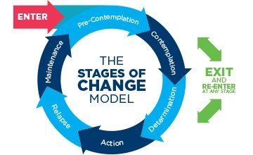
Public health professionals have found that individuals who successfully quit smoking benefit from a multifaceted approach including behavior change tools, policy changes, and programs. This presentation will highlight some of the lessons learned from smoking cessation initiatives, and how they can be applied to increase rates of active transportation.
The Transtheoretical Model (TTM) of change is commonly used as a behavior change tool to help people quit smoking. Using a personalized approach, the TTM guides individuals from one stage of change to the next (e.g., precontemplation, contemplation, preparation, action, maintenance, termination) with the ultimate goal of quitting. This same model can be applied to helping people transition from driving as a primary source of transportation to using non-motorized options. Additionally, taxing cigarettes had a significant impact on incentivizing quitting smoking, and increasing the cost of driving could have a similar impact on automobile dependence. Finally, just as states invested in programs such as quit lines to support individuals quitting smoking, more funds could be dedicated to improving safe-street infrastructure as research indicates that more users will adopt active transportation options when safe routes exist for people of all ages and abilities.
A Love Letter to My Home State
Thursday 9/15 9:00 AM:
South Carolina has the 2nd highest pedestrian fatality rate in the U.S. and is 48th in per capita active transportation spending. We have the 7th highest rate of Type 2 diabetes in the U.S. and a third of our residents are obese. But did you hear about the inmates who are leading a community garden program where harvested foods are shared via mobile market to food desert neighborhoods? And did you know that South Carolina is home to the first bike share system in the Southeast, launched all the way back in 2011 (one of the oldest systems in the country!)? And what about the peer to peer information exchange between our pioneering state health department and other agencies working to develop safe routes to healthy food? Or the food overlay district that is transforming the economic profile of a city’s downtown while also providing a processing center to make small-scale farming and production economically viable? And then there’s the nonprofit spearheading our cross-state mountains-to-sea trail that partnered with a local brewer to create its very own pale ale (and raise a few bucks along the way). No? You didn’t hear about that? Well, pull up a chair. There’s more.
Stairways for Bikes
Thursday 9/15 10:15 AM:
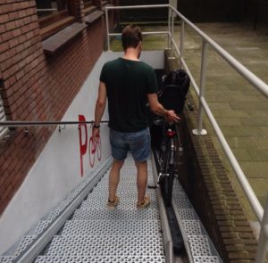
Stairs often serve as direct pedestrian connections to bridges, underpasses, and through streets in steeper geographies. However, for pedestrians walking with a bicycle, stairs can be a complete barrier, forcing long detours or lifting and carrying a heavy bicycle. There are several instances when a cyclist is walking a bicycle and would use a stairway, such as accessing a transit stop, using a pedestrian bridge, walking with a friend who doesn’t have a bike, or if the bicycle has a flat tire or other mishap. Recently, channels have been installed on stairways to facilitate rolling a bicycle wheel up or down. However, steep stair pitch, limited stair width, poor landing transitions, and handrails have thwarted the practical use of these wheeling channels, despite good design intentions. Moreover, some of these wheeling channel installations pose a tripping hazard for other pedestrians. This pecha kucha will present design details and international examples for best practices to properly design a staircase and wheeling channel such that bicyclists can easily roll their bikes up and down a staircase while still maintaining accessibility for other pedestrians.
What Can We Learn from the City of Medellin about Planning and Implementing Greenways in Underserved Communities?
Thursday 9/15 10:15 AM:
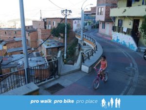
Over the past several decades, the population of Medellin has surged as people throughout the country fled civil war and drug trafficking. During much of that time, urban planning efforts did not address the needs of the rapidly growing neighbourhoods that encroach on the steep slopes that ring the urban core of the city. The result is that vast swaths of the city are unplanned districts with little in the way of civic infrastructure or services.
With the subsistence of violence, the city has begun implementing plans to improve the existence of residents in underserved neighborhoods. Ultimately, a network of greenways that will organize neighbourhoods, mark the expansion of the city, improve natural habitats and improve mobility and accessibility to underserved neighbourhoods throughout the city. Currently, several pieces of the network are in place and more segments are slated for construction in the coming years. In a world experiencing rapid urban development, greenway and open space planning is often an afterthought, much to the detriment to underserved neighborhoods. This Pecha Kucha will show how modest investments in well planned greenway networks in Medellin are beginning to have substantial improvements to the lives of underserved residents.

